GPX to KML
Drop in a GPX and get a KML with every point of the track kept. It is the format Google My Maps and Google Earth import without losing anything.
Your file never leaves your browser. The conversion runs on this page, in JavaScript: nothing is uploaded, nothing is stored, and we never see the file. Open your browser's network panel while you convert - there is no request to look at.
These tools run in your browser, so they need JavaScript. With JavaScript off there is nothing we can do here - but the same conversions run server-side on motogpx.org, which works without it.
Your KML
Used for the map title inside the KML and for the downloaded file name.
How to import it into Google My Maps
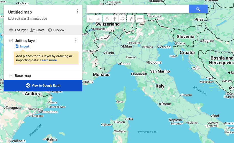
- Open mymaps.google.com and click "Create a new map".
- Click "Import" under the untitled layer.
- Choose the KML you just downloaded.
- The track appears on the map with all its points - not eleven stops, all of them.
Questions
Why KML and not a Google Maps link?
Because a link holds eleven stops at most - a start, an end and nine waypoints - which is Google's limit on the URL format. A track with ten thousand points has to be sampled down to eleven, and between them Maps works out its own route. A KML has no such limit: every point survives. Use the link to navigate on your phone, the KML to see or keep the real track.
Does it work with Google Earth?
Yes - just open the file. Google Earth reads KML natively, and a track imported this way keeps its shape exactly, which makes it the easiest way to fly along a route you have ridden.
What gets lost in the conversion?
The coordinates, all of them, survive untouched. What a KML line does not carry is the timestamps and the elevation of each point: it is a drawn line, not a recording. If you need those, keep the GPX as well - this tool never touches your original file.
The other tools
You have the GPX and you want the route on your phone. Get a ready-made Google Maps link, plus a KML that keeps every single point for Google My Maps.
in your browserGoogle MapsGPXYou planned the route on Google Maps and your sat-nav wants a GPX. The roads between your stops are rebuilt point by point, and you can correct them on the map.
needs our serverKMLGPXYou drew the route in Google My Maps or Google Earth. This is the most faithful conversion there is: a KML already contains the line you drew, so nothing has to be guessed.
in your browserGPX / KML / KMZYou just want to see what is in the file: the track on a map, its distance, its points, and the time it took.
in your browser